
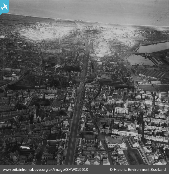
SAW019610 SCOTLAND (1948). Aberdeen, general view, showing Union Street and University of Aberdeen Marischal College. An oblique aerial photograph taken facing north-east. This image has been produced from a print.
© Hawlfraint cyfranwyr OpenStreetMap a thrwyddedwyd gan yr OpenStreetMap Foundation. 2026. Trwyddedir y gartograffeg fel CC BY-SA.
Delweddau cyfagos (20)
SAW019610

SAW019609

SPW022075

SAW014827

SAW022562

SAW014809

SPW022072

SPW060047

SAW019612

SAW022558

SAW022563

SAW019613

SAW022560

SAW022564

SAW022818

SAW022822

SAW022827

SAW019606

SAW019603

SPW060043

Manylion
| Pennawd | [SAW019610] Aberdeen, general view, showing Union Street and University of Aberdeen Marischal College. An oblique aerial photograph taken facing north-east. This image has been produced from a print. |
| Cyfeirnod | SAW019610 |
| Dyddiad | 1948 |
| Dolen | NRHE Collection item 1314984 |
| Enw lle | |
| Plwyf | ABERDEEN |
| Ardal | CITY OF ABERDEEN |
| Gwlad | SCOTLAND |
| Dwyreiniad / Gogleddiad | 394004, 806105 |
| Hydred / Lledred | -2.0991009962511, 57.145978905958 |
| Cyfeirnod Grid Cenedlaethol | NJ940061 |
Pinnau
Byddwch y cyntaf i ychwanegu sylw at y ddelwedd hon!