
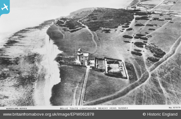
EPW061878 ENGLAND (1939). The Belle Tout Lighthouse, Beachy Head, 1939. This image has been produced from a copy-negative.
© Hawlfraint cyfranwyr OpenStreetMap a thrwyddedwyd gan yr OpenStreetMap Foundation. 2026. Trwyddedir y gartograffeg fel CC BY-SA.
Delweddau cyfagos (10)
EPW061878

EPW061872

EPW061876

EPW061877

EPW061875

EPW061879

EPW061874

EPW061873

EPW061880

EPW061881

Manylion
| Pennawd | [EPW061878] The Belle Tout Lighthouse, Beachy Head, 1939. This image has been produced from a copy-negative. |
| Cyfeirnod | EPW061878 |
| Dyddiad | 12-June-1939 |
| Dolen | |
| Enw lle | BEACHY HEAD |
| Plwyf | |
| Ardal | |
| Gwlad | ENGLAND |
| Dwyreiniad / Gogleddiad | 556321, 95529 |
| Hydred / Lledred | 0.21561596841759, 50.737734629822 |
| Cyfeirnod Grid Cenedlaethol | TV563955 |
Pinnau
Byddwch y cyntaf i ychwanegu sylw at y ddelwedd hon!
Cyfraniadau Grŵp

Belle Tout Lighthouse |

Alan McFaden |
Wednesday 12th of November 2014 05:37:27 PM |