
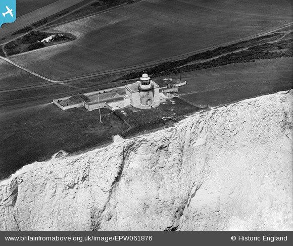
EPW061876 ENGLAND (1939). The Belle Tout Lighthouse, Beachy Head, 1939
© Hawlfraint cyfranwyr OpenStreetMap a thrwyddedwyd gan yr OpenStreetMap Foundation. 2026. Trwyddedir y gartograffeg fel CC BY-SA.
Delweddau cyfagos (10)
EPW061876

EPW061873

EPW061877

EPW061874

EPW061875

EPW061878

EPW061879

EPW061872

EPW061880

EPW061881

Manylion
| Pennawd | [EPW061876] The Belle Tout Lighthouse, Beachy Head, 1939 |
| Cyfeirnod | EPW061876 |
| Dyddiad | 12-June-1939 |
| Dolen | |
| Enw lle | BEACHY HEAD |
| Plwyf | |
| Ardal | |
| Gwlad | ENGLAND |
| Dwyreiniad / Gogleddiad | 556344, 95499 |
| Hydred / Lledred | 0.21592897007589, 50.737458829124 |
| Cyfeirnod Grid Cenedlaethol | TV563955 |
Pinnau

Alan McFaden |
Friday 23rd of August 2013 10:18:35 AM |
