
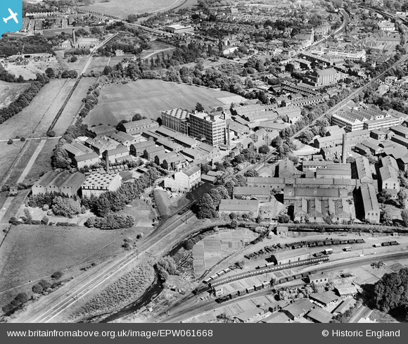
EPW061668 ENGLAND (1939). The Linoleum Manufacturing Company Works, the Staines West Branch Railway Line and environs, Staines, 1939
© Hawlfraint cyfranwyr OpenStreetMap a thrwyddedwyd gan yr OpenStreetMap Foundation. 2026. Trwyddedir y gartograffeg fel CC BY-SA.
Delweddau cyfagos (23)
EPW061668

EPW023474

EPW023485

EPW023475

EPW009568

EPW023471

EPW023478

EPW061666

EPW023472

EPW023491

EPW023473

EPW023488

EPW061671

EPW061676

EPW009570

EPW023477

EPW023480

EPW009567

EPW061672

EPW009569

EPW061665

EPW049560

EPW023481

Manylion
| Pennawd | [EPW061668] The Linoleum Manufacturing Company Works, the Staines West Branch Railway Line and environs, Staines, 1939 |
| Cyfeirnod | EPW061668 |
| Dyddiad | 10-June-1939 |
| Dolen | |
| Enw lle | STAINES |
| Plwyf | |
| Ardal | |
| Gwlad | ENGLAND |
| Dwyreiniad / Gogleddiad | 503531, 172007 |
| Hydred / Lledred | -0.51034196623796, 51.43709716582 |
| Cyfeirnod Grid Cenedlaethol | TQ035720 |
Pinnau

Billy121 |
Thursday 17th of July 2014 01:48:49 PM |