
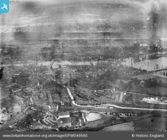
EPW049560 ENGLAND (1936). The area around Staines West Branch Railway Goods Shed and the River Thames in flood, Staines, from the north-east, 1936. This image has been produced from a damaged negative.
© Hawlfraint cyfranwyr OpenStreetMap a thrwyddedwyd gan yr OpenStreetMap Foundation. 2026. Trwyddedir y gartograffeg fel CC BY-SA.
Delweddau cyfagos (17)
EPW049560

EPW061676

EPW061666

EPW009570

EPW023475

EPW023472

EPW009567

EPW023488

EPW023491

EPW023471

EPW023473

EPW061668

EPW061665

EPW009569

EPW023480

EPW023481

EPW061671

Manylion
| Pennawd | [EPW049560] The area around Staines West Branch Railway Goods Shed and the River Thames in flood, Staines, from the north-east, 1936. This image has been produced from a damaged negative. |
| Cyfeirnod | EPW049560 |
| Dyddiad | January-1936 |
| Dolen | |
| Enw lle | STAINES |
| Plwyf | |
| Ardal | |
| Gwlad | ENGLAND |
| Dwyreiniad / Gogleddiad | 503286, 171982 |
| Hydred / Lledred | -0.51387317236272, 51.436917158354 |
| Cyfeirnod Grid Cenedlaethol | TQ033720 |
Pinnau

Class31 |
Tuesday 15th of September 2015 04:48:08 PM |
