
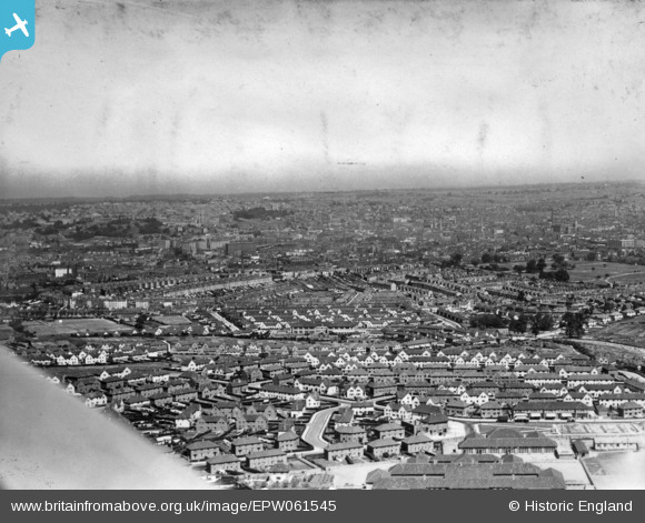
EPW061545 ENGLAND (1939). A cityscape from Filwood Park towards the city centre, Bristol, from the south, 1939. This image has been produced from a print.
© Hawlfraint cyfranwyr OpenStreetMap a thrwyddedwyd gan yr OpenStreetMap Foundation. 2026. Trwyddedir y gartograffeg fel CC BY-SA.
Delweddau cyfagos (4)
EPW061545

EPW048305

EPW048303

EPW048304

Manylion
| Pennawd | [EPW061545] A cityscape from Filwood Park towards the city centre, Bristol, from the south, 1939. This image has been produced from a print. |
| Cyfeirnod | EPW061545 |
| Dyddiad | 5-June-1939 |
| Dolen | |
| Enw lle | BRISTOL |
| Plwyf | |
| Ardal | |
| Gwlad | ENGLAND |
| Dwyreiniad / Gogleddiad | 359213, 170127 |
| Hydred / Lledred | -2.5867380887953, 51.428187268802 |
| Cyfeirnod Grid Cenedlaethol | ST592701 |
Pinnau

Matt Aldred edob.mattaldred.com |
Sunday 28th of June 2026 06:11:56 PM | |

Durbandeep |
Friday 21st of October 2016 03:42:43 PM | |
|
JMR4203 |
Wednesday 22nd of April 2015 11:24:23 PM | |
|
JMR4203 |
Wednesday 22nd of April 2015 11:23:23 PM | |
|
JMR4203 |
Wednesday 22nd of April 2015 11:22:57 PM |