
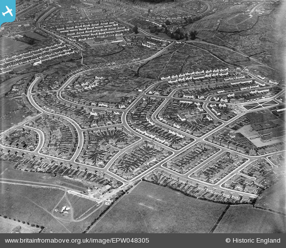
EPW048305 ENGLAND (1935). The residential area at Lower Knowle, Novers Park, 1935
© Hawlfraint cyfranwyr OpenStreetMap a thrwyddedwyd gan yr OpenStreetMap Foundation. 2026. Trwyddedir y gartograffeg fel CC BY-SA.
Delweddau cyfagos (4)
EPW048305

EPW048303

EPW048304

EPW061545

Manylion
| Pennawd | [EPW048305] The residential area at Lower Knowle, Novers Park, 1935 |
| Cyfeirnod | EPW048305 |
| Dyddiad | July-1935 |
| Dolen | |
| Enw lle | NOVERS PARK |
| Plwyf | |
| Ardal | |
| Gwlad | ENGLAND |
| Dwyreiniad / Gogleddiad | 359046, 170083 |
| Hydred / Lledred | -2.5891352293182, 51.427779566541 |
| Cyfeirnod Grid Cenedlaethol | ST590701 |
Pinnau

Class31 |
Thursday 27th of February 2014 11:40:25 PM | |
|
Class31 |
Thursday 27th of February 2014 11:39:52 PM | |
|
Class31 |
Thursday 27th of February 2014 11:38:43 PM | |
|
Class31 |
Thursday 27th of February 2014 11:38:16 PM | |
|
Class31 |
Thursday 27th of February 2014 11:34:04 PM | |
|
Class31 |
Thursday 27th of February 2014 11:33:20 PM | |
|
Class31 |
Thursday 27th of February 2014 11:32:29 PM | |
|
Class31 |
Thursday 27th of February 2014 11:31:38 PM | |
|
Class31 |
Thursday 27th of February 2014 11:31:09 PM | |
|
Class31 |
Thursday 27th of February 2014 11:30:27 PM | |
|
Class31 |
Thursday 27th of February 2014 11:29:33 PM | |
|
Class31 |
Thursday 27th of February 2014 11:28:23 PM | |
|
Class31 |
Thursday 27th of February 2014 11:28:03 PM | |
|
Class31 |
Thursday 27th of February 2014 11:27:39 PM | |
|
Class31 |
Thursday 27th of February 2014 11:27:14 PM | |
|
Class31 |
Thursday 27th of February 2014 11:26:13 PM | |
|
Class31 |
Thursday 27th of February 2014 11:25:52 PM | |
|
Class31 |
Thursday 27th of February 2014 11:25:33 PM | |
|
Class31 |
Thursday 27th of February 2014 11:24:55 PM | |
|
Class31 |
Thursday 27th of February 2014 11:24:31 PM | |
|
Class31 |
Thursday 27th of February 2014 11:23:54 PM | |
|
Class31 |
Thursday 27th of February 2014 11:23:01 PM | |
|
Class31 |
Thursday 27th of February 2014 11:22:32 PM | |
|
Class31 |
Thursday 27th of February 2014 11:22:03 PM | |
|
Class31 |
Thursday 27th of February 2014 11:21:37 PM | |
|
Class31 |
Thursday 27th of February 2014 11:20:43 PM | |
|
Class31 |
Thursday 27th of February 2014 11:20:24 PM | |
|
Class31 |
Thursday 27th of February 2014 11:19:42 PM | |
|
Class31 |
Thursday 27th of February 2014 11:19:23 PM | |
|
Class31 |
Thursday 27th of February 2014 11:18:53 PM | |
|
Class31 |
Thursday 27th of February 2014 11:18:33 PM | |
|
Class31 |
Thursday 27th of February 2014 11:17:54 PM |
Cyfraniadau Grŵp
View looking north |
Class31 |
Thursday 27th of February 2014 11:41:48 PM |