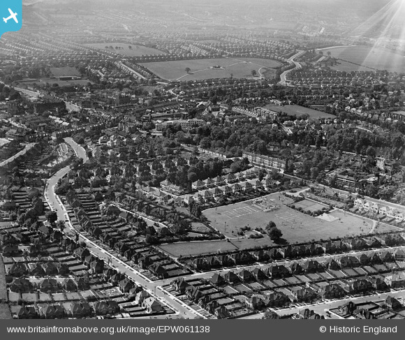
EPW061138 ENGLAND (1939). Stonegrove Park, Green Lane and environs, Edgware, from the north, 1939
    © Hawlfraint cyfranwyr OpenStreetMap a thrwyddedwyd gan yr OpenStreetMap Foundation. 2025. Trwyddedir y gartograffeg fel CC BY-SA.
  
Delweddau cyfagos (10)
Manylion
| Pennawd | [EPW061138] Stonegrove Park, Green Lane and environs, Edgware, from the north, 1939 | 
| Cyfeirnod | EPW061138 | 
| Dyddiad | 30-May-1939 | 
| Dolen | |
| Enw lle | EDGWARE | 
| Plwyf | |
| Ardal | |
| Gwlad | ENGLAND | 
| Dwyreiniad / Gogleddiad | 519042, 192074 | 
| Hydred / Lledred | -0.28047963684097, 51.614420512274 | 
| Cyfeirnod Grid Cenedlaethol | TQ190921 | 
Pinnau
|  Air Raid Shelters under construction
CIVIL AIR RAID SHELTER: e65589 |   Matt Aldred edob.mattaldred.com | Wednesday 19th of April 2023 09:33:55 PM | 
|  38 Whitchurch Gdns |   mc52 | Wednesday 9th of July 2014 10:31:11 PM | 
| Class31 | Friday 21st of February 2014 12:45:09 PM | |
|  Edgware Town FC football ground.  I believe the club was formed in the year of this image, 1939.  The ground was virtually unchanged in the 50s and early 60s. |   colsouth111 | Wednesday 28th of August 2013 01:51:30 PM | 
 
             
  ![[EPW061138] Stonegrove Park, Green Lane and environs, Edgware, from the north, 1939](http://britainfromabove.org.uk/sites/all/libraries/aerofilms-images/public/100x100/EPW/061/EPW061138.jpg) 
  
                                          ![[EPW034548] New housing around Stone Grove and environs, Edgware, from the south-west, 1930](http://britainfromabove.org.uk/sites/all/libraries/aerofilms-images/public/100x100/EPW/034/EPW034548.jpg) 
 ![[EPW034547] The High Street and new housing around Manor Park Crescent and environs, Edgware, 1930](http://britainfromabove.org.uk/sites/all/libraries/aerofilms-images/public/100x100/EPW/034/EPW034547.jpg) 
 ![[EPW034623] Housing development to the north of the old village, Edgware, from the south-west, 1930](http://britainfromabove.org.uk/sites/all/libraries/aerofilms-images/public/100x100/EPW/034/EPW034623.jpg) 
 ![[EAW027667] A Hunting Aerosurveys DH.89A Rapide (G-AEAL) in flight over the Broadfields Avenue area, Edgware, from the south-west, 1949](http://britainfromabove.org.uk/sites/all/libraries/aerofilms-images/public/100x100/EAW/027/EAW027667.jpg) 
 ![[EPW034556] New housing around Green Lane, Edgware, from the south-east, 1930](http://britainfromabove.org.uk/sites/all/libraries/aerofilms-images/public/100x100/EPW/034/EPW034556.jpg) 
 ![[EPW034550] New housing around Green Lane, Edgware, from the south-west, 1930](http://britainfromabove.org.uk/sites/all/libraries/aerofilms-images/public/100x100/EPW/034/EPW034550.jpg) 
 ![[EPW034619] Housing development around Green Lane, Edgware, from the south-west, 1930](http://britainfromabove.org.uk/sites/all/libraries/aerofilms-images/public/100x100/EPW/034/EPW034619.jpg) 
 ![[EPW034551] Fields at Hill House, Edgware, 1930](http://britainfromabove.org.uk/sites/all/libraries/aerofilms-images/public/100x100/EPW/034/EPW034551.jpg) 
 ![[EPW034621] Housing development to the north of the old village, Edgware, from the south, 1930](http://britainfromabove.org.uk/sites/all/libraries/aerofilms-images/public/100x100/EPW/034/EPW034621.jpg) 
 