
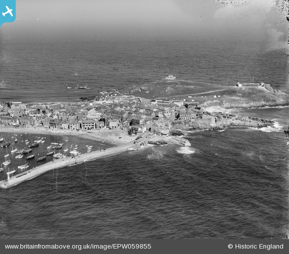
EPW059855 ENGLAND (1938). St Ives Head, St Ives, from the south-east, 1938
© Hawlfraint cyfranwyr OpenStreetMap a thrwyddedwyd gan yr OpenStreetMap Foundation. 2025. Trwyddedir y gartograffeg fel CC BY-SA.
Delweddau cyfagos (10)
EPW059855

EPW021745

EPW021747

EPW021752

EAW257342

EPW039835

EPW021744

EPW039834

EPW021748

EPW039833

Manylion
| Pennawd | [EPW059855] St Ives Head, St Ives, from the south-east, 1938 |
| Cyfeirnod | EPW059855 |
| Dyddiad | 22-September-1938 |
| Dolen | |
| Enw lle | ST IVES |
| Plwyf | ST. IVES |
| Ardal | |
| Gwlad | ENGLAND |
| Dwyreiniad / Gogleddiad | 152122, 40749 |
| Hydred / Lledred | -5.47491392761, 50.214110359365 |
| Cyfeirnod Grid Cenedlaethol | SW521407 |
Pinnau

totoro |
Wednesday 2nd of April 2014 09:44:15 PM | |
|
totoro |
Saturday 15th of June 2013 11:45:59 AM | |
|
totoro |
Saturday 15th of June 2013 11:45:17 AM | |
|
totoro |
Saturday 15th of June 2013 11:44:16 AM | |
|
totoro |
Saturday 15th of June 2013 11:42:35 AM | |
|
totoro |
Saturday 15th of June 2013 11:41:23 AM |