
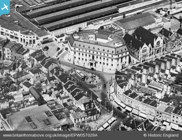
EPW057029A ENGLAND (1938). The Town Hall (extract from glass plate 57029), Wimbledon, 1938. This image has been produced from a copy-negative.
© Hawlfraint cyfranwyr OpenStreetMap a thrwyddedwyd gan yr OpenStreetMap Foundation. 2026. Trwyddedir y gartograffeg fel CC BY-SA.
Delweddau cyfagos (10)
EPW057029A
, Wimbledon, 1938. This image has been produced from a copy-negative.")
EPW057029

EPW057029B
, Wimbledon, 1938. This image was modified by the Aerofilms Ltd Artists' Department and has been produced from a copy-negative.")
EPW057027

EPW011654

EPW057031

EPW011653

EPW010723

EPW057030

EPW057026

Manylion
| Pennawd | [EPW057029A] The Town Hall (extract from glass plate 57029), Wimbledon, 1938. This image has been produced from a copy-negative. |
| Cyfeirnod | EPW057029A |
| Dyddiad | 5-May-1938 |
| Dolen | |
| Enw lle | WIMBLEDON |
| Plwyf | |
| Ardal | |
| Gwlad | ENGLAND |
| Dwyreiniad / Gogleddiad | 524902, 170601 |
| Hydred / Lledred | -0.20348930832023, 51.420150465369 |
| Cyfeirnod Grid Cenedlaethol | TQ249706 |
Pinnau

Nowy Paul |
Saturday 23rd of December 2017 02:08:23 PM | |
|
Arthur |
Tuesday 15th of March 2016 10:22:19 AM |