
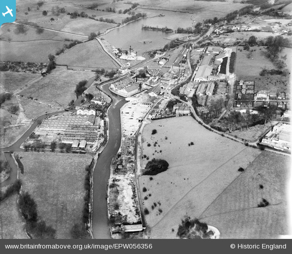
EPW056356 ENGLAND (1938). Harefield Mills on the Grand Union Canal and the site of the disused Harefield Mills, Harefield, 1938
© Hawlfraint cyfranwyr OpenStreetMap a thrwyddedwyd gan yr OpenStreetMap Foundation. 2026. Trwyddedir y gartograffeg fel CC BY-SA.
Delweddau cyfagos (24)
EPW056356

EPW056357

EPW006203

EPW006653

EPW006655

EPW006656

EPW006664

EPW006660

EPW006665

EPW006662

EPW041109
 on the Grand Union Canal, Harefield, 1933")
EPW006659

EPW056355

EPW006657

EPW006668

EPW041108
 on the Grand Union Canal, Harefield, 1933")
EPW056349

EPW057662

EPW057661

EPW006654

EPW006658

EPW006663

EPW006667

EPW006666

Manylion
| Pennawd | [EPW056356] Harefield Mills on the Grand Union Canal and the site of the disused Harefield Mills, Harefield, 1938 |
| Cyfeirnod | EPW056356 |
| Dyddiad | 5-February-1938 |
| Dolen | |
| Enw lle | HAREFIELD |
| Plwyf | |
| Ardal | |
| Gwlad | ENGLAND |
| Dwyreiniad / Gogleddiad | 504132, 190926 |
| Hydred / Lledred | -0.49610489438241, 51.607057145794 |
| Cyfeirnod Grid Cenedlaethol | TQ041909 |
Pinnau
Byddwch y cyntaf i ychwanegu sylw at y ddelwedd hon!