
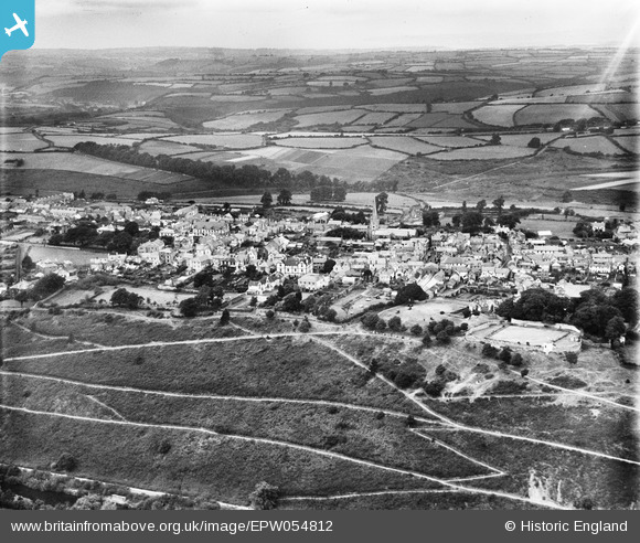
EPW054812 ENGLAND (1937). The town, Great Torrington, from the south, 1937
© Hawlfraint cyfranwyr OpenStreetMap a thrwyddedwyd gan yr OpenStreetMap Foundation. 2026. Trwyddedir y gartograffeg fel CC BY-SA.
Delweddau cyfagos (8)
EPW054812

EPW033169

EPW033168

EPW054811

EPW033171

EPW054813

EPW054810

EPW033170

Manylion
| Pennawd | [EPW054812] The town, Great Torrington, from the south, 1937 |
| Cyfeirnod | EPW054812 |
| Dyddiad | August-1937 |
| Dolen | |
| Enw lle | GREAT TORRINGTON |
| Plwyf | GREAT TORRINGTON |
| Ardal | |
| Gwlad | ENGLAND |
| Dwyreiniad / Gogleddiad | 249548, 118936 |
| Hydred / Lledred | -4.1421100187326, 50.949649647647 |
| Cyfeirnod Grid Cenedlaethol | SS495189 |
Pinnau

Donal Lucey |
Tuesday 4th of March 2025 05:57:30 PM | |
|
Donal Lucey |
Tuesday 4th of March 2025 05:57:07 PM | |
|
Donal Lucey |
Tuesday 4th of March 2025 05:56:34 PM |