
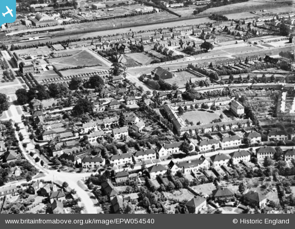
EPW054540 ENGLAND (1937). The residential area surrounding Homerfield and Guessens Court, Welwyn Garden City, 1937. This image has been produced from a copy-negative.
© Hawlfraint cyfranwyr OpenStreetMap a thrwyddedwyd gan yr OpenStreetMap Foundation. 2026. Trwyddedir y gartograffeg fel CC BY-SA.
Delweddau cyfagos (22)
EPW054540

EPW047379

EPW054540A

EPW054542

EPW047357

EPW022030

EPW047367

EPW047356

EPW047369

EPW047368

EPW047377

EPW047376

EPW013424

EAW035461

EAW013992

EPW022018

EPW022027

EPW054531

EPW047366

EPW062075

EPW054532

EPW022026

Manylion
| Pennawd | [EPW054540] The residential area surrounding Homerfield and Guessens Court, Welwyn Garden City, 1937. This image has been produced from a copy-negative. |
| Cyfeirnod | EPW054540 |
| Dyddiad | 30-July-1937 |
| Dolen | |
| Enw lle | WELWYN GARDEN CITY |
| Plwyf | |
| Ardal | |
| Gwlad | ENGLAND |
| Dwyreiniad / Gogleddiad | 523408, 212936 |
| Hydred / Lledred | -0.21005947263179, 51.800983956723 |
| Cyfeirnod Grid Cenedlaethol | TL234129 |
Pinnau
Byddwch y cyntaf i ychwanegu sylw at y ddelwedd hon!