
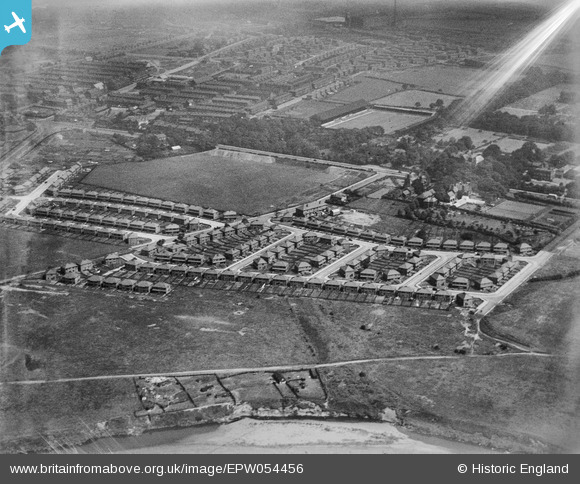
EPW054456 ENGLAND (1937). The residential area surrounding Windermere Drive and Coniston Drive and Bury Football Ground, Redvales, 1937. This image has been affected by flare.
© Hawlfraint cyfranwyr OpenStreetMap a thrwyddedwyd gan yr OpenStreetMap Foundation. 2026. Trwyddedir y gartograffeg fel CC BY-SA.
Delweddau cyfagos (5)
EPW054456

EPW054454

EPW054453

EPW054455

EPW054457

Manylion
| Pennawd | [EPW054456] The residential area surrounding Windermere Drive and Coniston Drive and Bury Football Ground, Redvales, 1937. This image has been affected by flare. |
| Cyfeirnod | EPW054456 |
| Dyddiad | 30-July-1937 |
| Dolen | |
| Enw lle | REDVALES |
| Plwyf | |
| Ardal | |
| Gwlad | ENGLAND |
| Dwyreiniad / Gogleddiad | 380237, 409174 |
| Hydred / Lledred | -2.2985195304157, 53.578548363516 |
| Cyfeirnod Grid Cenedlaethol | SD802092 |
Pinnau
Byddwch y cyntaf i ychwanegu sylw at y ddelwedd hon!