
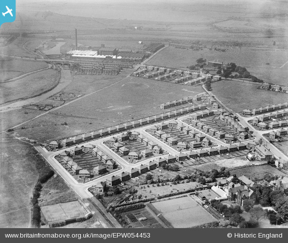
EPW054453 ENGLAND (1937). The residential area surrounding Windermere Drive and Coniston Drive and the Warth Cotton Weaving Mills, Redvales, from the east, 1937
© Hawlfraint cyfranwyr OpenStreetMap a thrwyddedwyd gan yr OpenStreetMap Foundation. 2026. Trwyddedir y gartograffeg fel CC BY-SA.
Delweddau cyfagos (5)
EPW054453

EPW054457

EPW054456

EPW054454

EPW054455

Manylion
| Pennawd | [EPW054453] The residential area surrounding Windermere Drive and Coniston Drive and the Warth Cotton Weaving Mills, Redvales, from the east, 1937 |
| Cyfeirnod | EPW054453 |
| Dyddiad | 30-July-1937 |
| Dolen | |
| Enw lle | REDVALES |
| Plwyf | |
| Ardal | |
| Gwlad | ENGLAND |
| Dwyreiniad / Gogleddiad | 380286, 409047 |
| Hydred / Lledred | -2.2977713756006, 53.577408576634 |
| Cyfeirnod Grid Cenedlaethol | SD803090 |
Pinnau
Byddwch y cyntaf i ychwanegu sylw at y ddelwedd hon!