
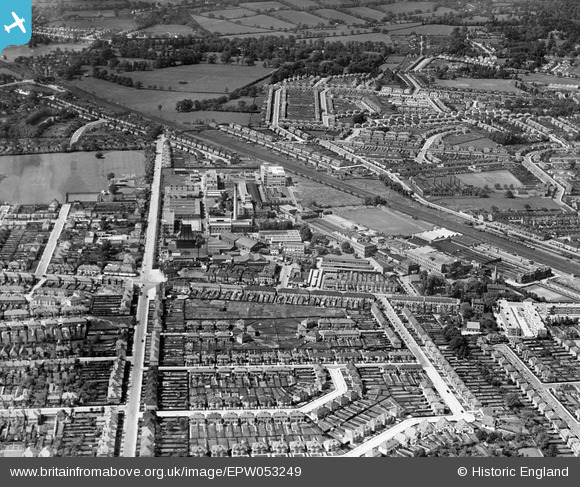
EPW053249 ENGLAND (1937). The Kodak Works and environs, Harrow, 1937
© Hawlfraint cyfranwyr OpenStreetMap a thrwyddedwyd gan yr OpenStreetMap Foundation. 2026. Trwyddedir y gartograffeg fel CC BY-SA.
Delweddau cyfagos (32)
EPW053249

EPW037281

EPW053247

EPW053245

EPW062558

EPW053255

EPW037265

EPW062560

EPW062563

EPW062750

EPW053246

EPW062568

EPW053251

EPW053257

EPW000475

EPW037264

EPW053248

EPW037260
, Harrow, 1932")
EPW000474

EPW062751

EPW037266

EPW037280

EPW037259
, Harrow, 1932")
EPW062561

EPW062753

EPW053254

EAW035177

EPW037262
, Harrow, 1932")
EPW062752

EPW037261
, Harrow, 1932")
EPW062565

EPW037263
, Harrow, 1932")
Manylion
| Pennawd | [EPW053249] The Kodak Works and environs, Harrow, 1937 |
| Cyfeirnod | EPW053249 |
| Dyddiad | 27-May-1937 |
| Dolen | |
| Enw lle | HARROW |
| Plwyf | |
| Ardal | |
| Gwlad | ENGLAND |
| Dwyreiniad / Gogleddiad | 514741, 189711 |
| Hydred / Lledred | -0.34335094040303, 51.594073768683 |
| Cyfeirnod Grid Cenedlaethol | TQ147897 |
Pinnau

czyrko |
Thursday 26th of August 2021 05:23:08 PM | |
|
czyrko |
Thursday 26th of August 2021 05:21:37 PM | |
|
czyrko |
Thursday 26th of August 2021 05:20:43 PM | |
|
Sweet Pete |
Monday 16th of March 2015 04:32:26 PM | |
|
Sweet Pete |
Monday 16th of March 2015 04:31:50 PM | |
|
Sweet Pete |
Monday 16th of March 2015 04:30:53 PM | |
|
Sweet Pete |
Monday 16th of March 2015 04:30:37 PM | |
|
Sweet Pete |
Monday 16th of March 2015 04:29:35 PM | |
|
Sweet Pete |
Monday 16th of March 2015 04:29:04 PM | |
|
Sweet Pete |
Monday 16th of March 2015 04:28:36 PM | |
|
Sweet Pete |
Monday 16th of March 2015 04:28:09 PM |