
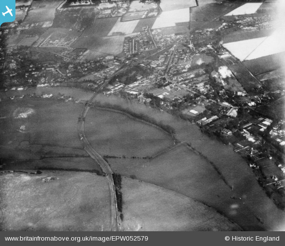
EPW052579 ENGLAND (1937). The River Thames near Cock Marsh, Bourne End, 1937. This image has been produced from a copy-negative.
© Hawlfraint cyfranwyr OpenStreetMap a thrwyddedwyd gan yr OpenStreetMap Foundation. 2026. Trwyddedir y gartograffeg fel CC BY-SA.
Delweddau cyfagos (3)
EPW052579

EAW028009

EPW052581

Manylion
| Pennawd | [EPW052579] The River Thames near Cock Marsh, Bourne End, 1937. This image has been produced from a copy-negative. |
| Cyfeirnod | EPW052579 |
| Dyddiad | 1-March-1937 |
| Dolen | |
| Enw lle | BOURNE END |
| Plwyf | WOOBURN |
| Ardal | |
| Gwlad | ENGLAND |
| Dwyreiniad / Gogleddiad | 489345, 186737 |
| Hydred / Lledred | -0.71066527744867, 51.571938800612 |
| Cyfeirnod Grid Cenedlaethol | SU893867 |
Pinnau
Byddwch y cyntaf i ychwanegu sylw at y ddelwedd hon!