
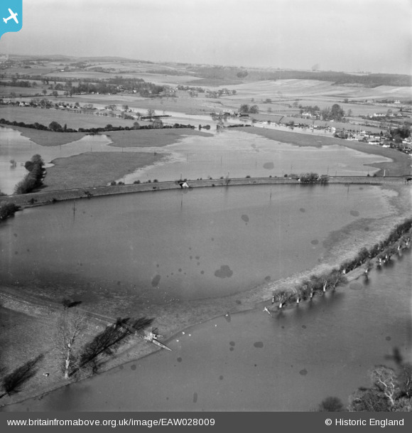
EAW028009 ENGLAND (1950). Flooding at Cock Marsh, Cookham, from the east, 1950. This image has been produced from a damaged negative.
© Hawlfraint cyfranwyr OpenStreetMap a thrwyddedwyd gan yr OpenStreetMap Foundation. 2026. Trwyddedir y gartograffeg fel CC BY-SA.
Delweddau cyfagos (2)
EAW028009

EPW052579

Manylion
| Pennawd | [EAW028009] Flooding at Cock Marsh, Cookham, from the east, 1950. This image has been produced from a damaged negative. |
| Cyfeirnod | EAW028009 |
| Dyddiad | 17-February-1950 |
| Dolen | |
| Enw lle | COOKHAM |
| Plwyf | COOKHAM |
| Ardal | |
| Gwlad | ENGLAND |
| Dwyreiniad / Gogleddiad | 489328, 186614 |
| Hydred / Lledred | -0.71094181798389, 51.570835710368 |
| Cyfeirnod Grid Cenedlaethol | SU893866 |
Pinnau

designking |
Saturday 20th of September 2014 09:32:04 PM |