
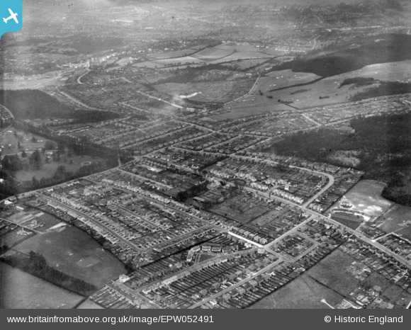
EPW052491 ENGLAND (1937). Housing around Foxearth Road, Sundale Avenue and environs, Selsdon, 1937. This image has been produced from a print.
© Hawlfraint cyfranwyr OpenStreetMap a thrwyddedwyd gan yr OpenStreetMap Foundation. 2026. Trwyddedir y gartograffeg fel CC BY-SA.
Delweddau cyfagos (23)
EPW052491

EPW052492

EPW026623

EPW015883

EPW015884

EPW015891

EPW026625

EPW052481

EPW052499

EPW052480

EPW052493

EPW015887

EPW026622

EPW026617

EPW026616

EPW015880

EPW015876

EPW015886

EPW052482

EPW052500

EPW026619

EPW052497

EPW015881

Manylion
| Pennawd | [EPW052491] Housing around Foxearth Road, Sundale Avenue and environs, Selsdon, 1937. This image has been produced from a print. |
| Cyfeirnod | EPW052491 |
| Dyddiad | 22-February-1937 |
| Dolen | |
| Enw lle | SELSDON |
| Plwyf | |
| Ardal | |
| Gwlad | ENGLAND |
| Dwyreiniad / Gogleddiad | 535044, 162403 |
| Hydred / Lledred | -0.060817179750297, 51.344144936717 |
| Cyfeirnod Grid Cenedlaethol | TQ350624 |
Pinnau
Byddwch y cyntaf i ychwanegu sylw at y ddelwedd hon!