
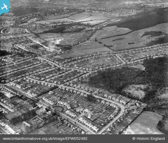
EPW052482 ENGLAND (1937). Housing around Foxearth Road and Farley Road, Croham Hurst Golf Course and environs, Selsdon, 1937. This image has been produced from a print.
© Hawlfraint cyfranwyr OpenStreetMap a thrwyddedwyd gan yr OpenStreetMap Foundation. 2026. Trwyddedir y gartograffeg fel CC BY-SA.
Delweddau cyfagos (18)
EPW052482

EPW052493

EPW015881

EPW026619

EPW052480

EPW026618

EPW026624

EPW015880

EPW015886

EPW026622

EPW015887

EPW015883

EPW026616

EPW015884

EPW052481

EPW052491

EPW035581

EPW052496

Manylion
| Pennawd | [EPW052482] Housing around Foxearth Road and Farley Road, Croham Hurst Golf Course and environs, Selsdon, 1937. This image has been produced from a print. |
| Cyfeirnod | EPW052482 |
| Dyddiad | 22-February-1937 |
| Dolen | |
| Enw lle | SELSDON |
| Plwyf | |
| Ardal | |
| Gwlad | ENGLAND |
| Dwyreiniad / Gogleddiad | 534886, 162591 |
| Hydred / Lledred | -0.063013354933906, 51.345872130041 |
| Cyfeirnod Grid Cenedlaethol | TQ349626 |
Pinnau

DaveSev |
Wednesday 19th of November 2014 06:59:16 PM |