
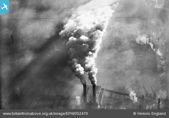
EPW052470 ENGLAND (1937). Smoke rising from Fulham Power Station, Sands End, from the west, 1937. This image has been produced fropm a copy-negative.
© Hawlfraint cyfranwyr OpenStreetMap a thrwyddedwyd gan yr OpenStreetMap Foundation. 2026. Trwyddedir y gartograffeg fel CC BY-SA.
Delweddau cyfagos (21)
EPW052470

EPW052470A

EPW052469

EPW052473

EPW052472

EPW052681

EPW052471

EPW021418

EPW021413

EPW021415

EPW021412

EPW021414

EPW053655

EPW021256

EPW021411

EPW060457

EPW045409

EPW021417

EPW021410

EPW041103

EPW041100

Manylion
| Pennawd | [EPW052470] Smoke rising from Fulham Power Station, Sands End, from the west, 1937. This image has been produced fropm a copy-negative. |
| Cyfeirnod | EPW052470 |
| Dyddiad | 13-February-1937 |
| Dolen | |
| Enw lle | SANDS END |
| Plwyf | |
| Ardal | |
| Gwlad | ENGLAND |
| Dwyreiniad / Gogleddiad | 526336, 176048 |
| Hydred / Lledred | -0.18092991248267, 51.468790587812 |
| Cyfeirnod Grid Cenedlaethol | TQ263760 |
Pinnau
Byddwch y cyntaf i ychwanegu sylw at y ddelwedd hon!