
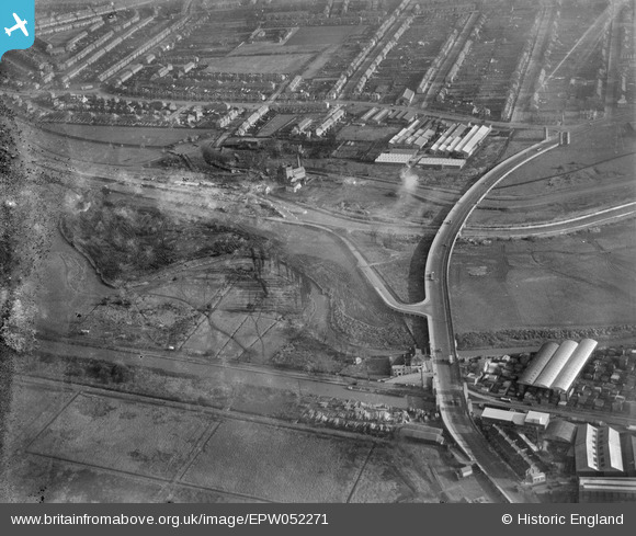
EPW052271 ENGLAND (1936). The junction of Lower Hall Lane and the North Circular Road, Edmonton, 1936. This image has been produced from a damaged negative.
© Hawlfraint cyfranwyr OpenStreetMap a thrwyddedwyd gan yr OpenStreetMap Foundation. 2026. Trwyddedir y gartograffeg fel CC BY-SA.
Delweddau cyfagos (24)
EPW052271

EPW056816

EPW056823

EPW058457

EPW056321

EPW050859

EPW058467

EPW056320

EPW052282

EPW055981

EPW053836

EPW056818

EPW053837

EPW049703

EPW049529

EPW018565

EPW018567

EPW052287

EPW055980

EPW018568

EPW018561

EPW060635

EPW018563

EPW018569

Manylion
| Pennawd | [EPW052271] The junction of Lower Hall Lane and the North Circular Road, Edmonton, 1936. This image has been produced from a damaged negative. |
| Cyfeirnod | EPW052271 |
| Dyddiad | November-1936 |
| Dolen | |
| Enw lle | EDMONTON |
| Plwyf | |
| Ardal | |
| Gwlad | ENGLAND |
| Dwyreiniad / Gogleddiad | 536089, 192401 |
| Hydred / Lledred | -0.034260929584081, 51.61349588669 |
| Cyfeirnod Grid Cenedlaethol | TQ361924 |
Pinnau
Byddwch y cyntaf i ychwanegu sylw at y ddelwedd hon!