
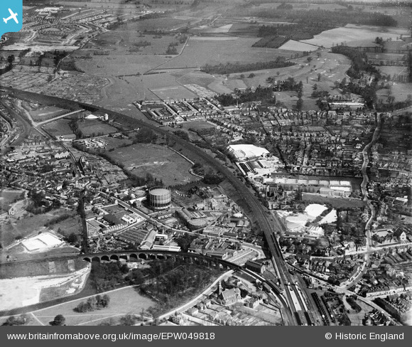
EPW049818 ENGLAND (1936). The London, Midland & Scottish Railway (LMSR) Bushey Curve, the High Street and environs, Watford, from the south-west, 1936
© Hawlfraint cyfranwyr OpenStreetMap a thrwyddedwyd gan yr OpenStreetMap Foundation. 2026. Trwyddedir y gartograffeg fel CC BY-SA.
Delweddau cyfagos (11)
EPW049818
 Bushey Curve, the High Street and environs, Watford, from the south-west, 1936")
EPW049825
 Bushey Curve and environs, Watford, 1936")
EPW049823
 Bushey Curve, the High Street and environs, Watford, 1936")
EPW049814
 Bushey Curve, the High Street and environs, Watford, from the south-west, 1936")
EPW049817
 Bushey Curve, the High Street and environs, Watford, from the south-east, 1936")
EPW049813

EPW060227

EPW049816

EPW049819

EPW021879

EPW049822

Manylion
| Pennawd | [EPW049818] The London, Midland & Scottish Railway (LMSR) Bushey Curve, the High Street and environs, Watford, from the south-west, 1936 |
| Cyfeirnod | EPW049818 |
| Dyddiad | April-1936 |
| Dolen | |
| Enw lle | WATFORD |
| Plwyf | |
| Ardal | |
| Gwlad | ENGLAND |
| Dwyreiniad / Gogleddiad | 511810, 195678 |
| Hydred / Lledred | -0.38374600214399, 51.648299084221 |
| Cyfeirnod Grid Cenedlaethol | TQ118957 |
Pinnau

OldBill |
Monday 5th of July 2021 08:32:09 PM | |
|
OldBill |
Monday 5th of July 2021 08:30:34 PM | |
|
OldBill |
Monday 5th of July 2021 08:29:18 PM | |
|
OldBill |
Monday 5th of July 2021 08:25:55 PM | |
|
OldBill |
Monday 5th of July 2021 08:25:23 PM | |
 |
Bluid |
Wednesday 7th of October 2020 08:25:42 AM |
|
The Laird |
Friday 7th of June 2019 12:20:31 PM | |
|
Brad |
Saturday 8th of October 2016 09:38:05 AM | |
|
Brightonboy |
Monday 14th of December 2015 08:10:40 AM | |
|
Brightonboy |
Monday 14th of December 2015 08:04:09 AM | |
|
Brightonboy |
Monday 14th of December 2015 08:04:04 AM | |
|
The Laird |
Thursday 17th of September 2015 11:48:11 AM | |
|
The Laird |
Thursday 17th of September 2015 11:47:01 AM | |
|
The Laird |
Thursday 17th of September 2015 11:42:24 AM | |
|
Bluid |
Sunday 12th of July 2015 09:04:56 AM | |
|
The Laird |
Saturday 11th of July 2015 12:08:12 PM | |
|
Bluid |
Tuesday 17th of June 2014 12:19:29 PM | |
|
Bluid |
Monday 10th of March 2014 12:58:18 AM | |
|
Bluid |
Thursday 27th of February 2014 07:18:37 AM | |
|
Bluid |
Tuesday 7th of May 2013 09:55:08 AM |


Cyfraniadau Grŵp

Oxhey Infants shown on far RHS |
Bluid |
Monday 10th of March 2014 12:59:47 AM |