
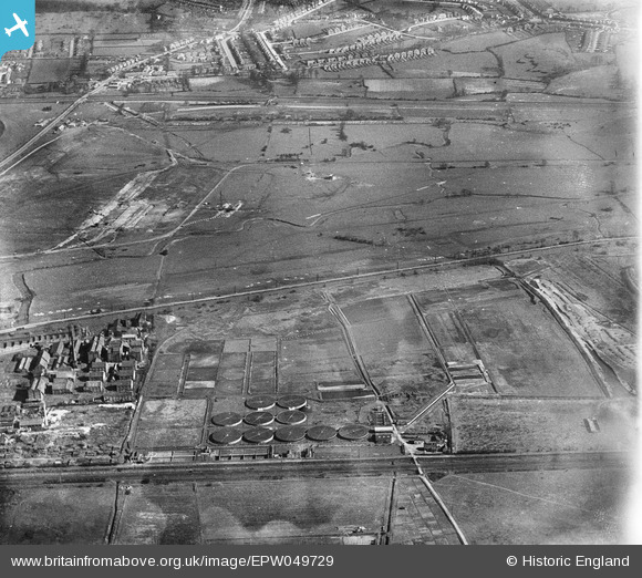
EPW049729 ENGLAND (1936). The site of the northern end of the William Girling Reservoir showing preliminary construction works, Ponders End, 1936
© Hawlfraint cyfranwyr OpenStreetMap a thrwyddedwyd gan yr OpenStreetMap Foundation. 2026. Trwyddedir y gartograffeg fel CC BY-SA.
Delweddau cyfagos (6)
EPW049729

EPW048907

EPW049695

EPW050867

EPW049694

EPW048905

Manylion
| Pennawd | [EPW049729] The site of the northern end of the William Girling Reservoir showing preliminary construction works, Ponders End, 1936 |
| Cyfeirnod | EPW049729 |
| Dyddiad | March-1936 |
| Dolen | |
| Enw lle | PONDERS END |
| Plwyf | |
| Ardal | |
| Gwlad | ENGLAND |
| Dwyreiniad / Gogleddiad | 536410, 194802 |
| Hydred / Lledred | -0.02869197253601, 51.634995951415 |
| Cyfeirnod Grid Cenedlaethol | TQ364948 |
Pinnau
Byddwch y cyntaf i ychwanegu sylw at y ddelwedd hon!