
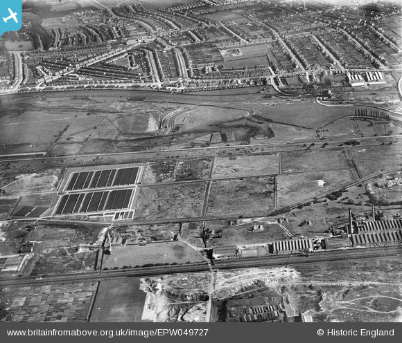
EPW049727 ENGLAND (1936). Edmonton Urban District Council Sewage Farm and the site of the southern end of the William Girling Reservoir showing preliminary construction works, Edmonton, 1936
© Hawlfraint cyfranwyr OpenStreetMap a thrwyddedwyd gan yr OpenStreetMap Foundation. 2026. Trwyddedir y gartograffeg fel CC BY-SA.
Delweddau cyfagos (12)
EPW049727

EPW049722

EPW049523

EPW049528

EPW048908

EPW049696

EPW058465
 Reservoir under construction, Edmonton, 1938")
EPW056326

EPW056319

EPW058471
 Reservoir under construction, Edmonton, from the south, 1938")
EPW049702

EPW056821

Manylion
| Pennawd | [EPW049727] Edmonton Urban District Council Sewage Farm and the site of the southern end of the William Girling Reservoir showing preliminary construction works, Edmonton, 1936 |
| Cyfeirnod | EPW049727 |
| Dyddiad | March-1936 |
| Dolen | |
| Enw lle | EDMONTON |
| Plwyf | |
| Ardal | |
| Gwlad | ENGLAND |
| Dwyreiniad / Gogleddiad | 535950, 192890 |
| Hydred / Lledred | -0.036077709911977, 51.617924140579 |
| Cyfeirnod Grid Cenedlaethol | TQ360929 |
Pinnau
Byddwch y cyntaf i ychwanegu sylw at y ddelwedd hon!