
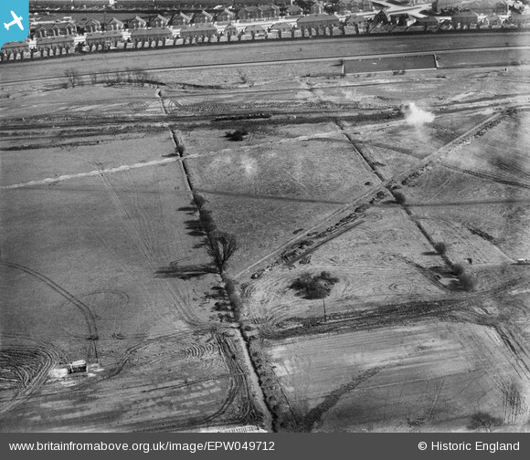
EPW049712 ENGLAND (1936). The site of the southern end of the William Girling Reservoir showing preliminary construction works, Edmonton, 1936
© Hawlfraint cyfranwyr OpenStreetMap a thrwyddedwyd gan yr OpenStreetMap Foundation. 2026. Trwyddedir y gartograffeg fel CC BY-SA.
Delweddau cyfagos (33)
EPW049712

EPW056325

EPW056316

EPW053855
 Reservoir under construction, Edmonton, 1937")
EPW055987

EPW056825

EPW058468
 Reservoir under construction, Edmonton, 1938")
EPW053841
 Reservoir under construction, Edmonton, 1937")
EPW056814

EPW060634

EPW060627

EPW050869

EPW053840
 Reservoir under construction, Edmonton, 1937")
EPW058460
 Reservoir under construction, Edmonton, 1938")
EPW053838
 Reservoir under construction, Edmonton, 1937")
EPW055982

EPW049714

EPW052273

EPW060209
 Reservoir under construction, Edmonton, 1938")
EPW050862

EPW060223
 Reservoir under construction, Edmonton, from the south, 1938")
EPW050863

EPW055983

EPW056817

EPW056822

EPW049702

EPW056317

EPW056327

EPW052281

EPW060629

EPW058471
 Reservoir under construction, Edmonton, from the south, 1938")
EPW056326

EPW049528

Manylion
| Pennawd | [EPW049712] The site of the southern end of the William Girling Reservoir showing preliminary construction works, Edmonton, 1936 |
| Cyfeirnod | EPW049712 |
| Dyddiad | March-1936 |
| Dolen | |
| Enw lle | EDMONTON |
| Plwyf | |
| Ardal | |
| Gwlad | ENGLAND |
| Dwyreiniad / Gogleddiad | 536384, 193162 |
| Hydred / Lledred | -0.029706272216836, 51.62026359693 |
| Cyfeirnod Grid Cenedlaethol | TQ364932 |
Pinnau
Byddwch y cyntaf i ychwanegu sylw at y ddelwedd hon!