
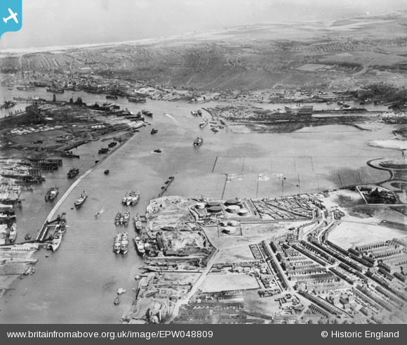
EPW048809 ENGLAND (1935). Northumberland Dock, the River Tyne and Jarrow Slake, Jarrow, 1935. This image has been produced from a copy-negative.
© Hawlfraint cyfranwyr OpenStreetMap a thrwyddedwyd gan yr OpenStreetMap Foundation. 2026. Trwyddedir y gartograffeg fel CC BY-SA.
Delweddau cyfagos (4)
EPW048809

EPW048347

EPW025065

EPW048810

Manylion
| Pennawd | [EPW048809] Northumberland Dock, the River Tyne and Jarrow Slake, Jarrow, 1935. This image has been produced from a copy-negative. |
| Cyfeirnod | EPW048809 |
| Dyddiad | August-1935 |
| Dolen | |
| Enw lle | JARROW |
| Plwyf | |
| Ardal | |
| Gwlad | ENGLAND |
| Dwyreiniad / Gogleddiad | 434220, 565784 |
| Hydred / Lledred | -1.4651892564828, 54.985400983503 |
| Cyfeirnod Grid Cenedlaethol | NZ342658 |
Pinnau

Linda Smith |
Tuesday 14th of August 2018 09:47:21 PM | |
|
N Dunn |
Tuesday 14th of August 2018 03:21:20 PM | |
|
N Dunn |
Saturday 21st of October 2017 03:46:46 PM | |
|
N Dunn |
Saturday 21st of October 2017 03:44:50 PM | |
|
N Dunn |
Saturday 21st of October 2017 03:43:38 PM | |
|
Porcy |
Thursday 4th of August 2016 01:25:03 AM | |
|
Porcy |
Thursday 4th of August 2016 01:23:54 AM | |
|
Porcy |
Thursday 4th of August 2016 01:22:45 AM | |

Dylan Moore |
Saturday 15th of November 2014 11:39:41 AM | |
|
N Dunn |
Thursday 6th of November 2014 03:17:54 PM | |
|
N Dunn |
Thursday 6th of November 2014 03:14:48 PM | |
|
N Dunn |
Thursday 6th of November 2014 03:12:36 PM |