
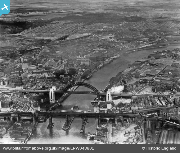
EPW048801 ENGLAND (1935). The High Level Bridge, Newcastle Swing Bridge, Tyne Bridge and the city, Newcastle upon Tyne, 1935. This image has been produced from a print.
© Hawlfraint cyfranwyr OpenStreetMap a thrwyddedwyd gan yr OpenStreetMap Foundation. 2026. Trwyddedir y gartograffeg fel CC BY-SA.
Delweddau cyfagos (12)
EPW048801

EAW600907

EPW048807

EPW051090

EPW051086

EPW051088

EPW051087

EPW051085

EPW048803

EPW051084

EPW051089

EPW048799

Manylion
| Pennawd | [EPW048801] The High Level Bridge, Newcastle Swing Bridge, Tyne Bridge and the city, Newcastle upon Tyne, 1935. This image has been produced from a print. |
| Cyfeirnod | EPW048801 |
| Dyddiad | August-1935 |
| Dolen | |
| Enw lle | NEWCASTLE UPON TYNE |
| Plwyf | |
| Ardal | |
| Gwlad | ENGLAND |
| Dwyreiniad / Gogleddiad | 425606, 563988 |
| Hydred / Lledred | -1.5999702432221, 54.969777610856 |
| Cyfeirnod Grid Cenedlaethol | NZ256640 |
