
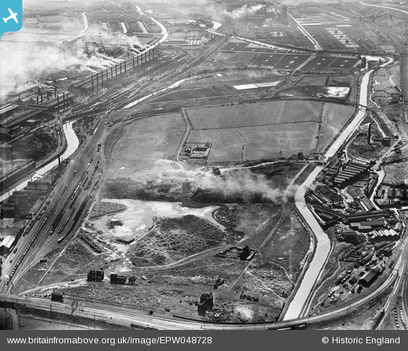
EPW048728 ENGLAND (1935). J.J. Habershon and Sons Holmes Steel Rolling Mills, the disused Holmes Colliery and the Templeborough Steel Works, Rotherham, from the north-east, 1935
© Hawlfraint cyfranwyr OpenStreetMap a thrwyddedwyd gan yr OpenStreetMap Foundation. 2026. Trwyddedir y gartograffeg fel CC BY-SA.
Delweddau cyfagos (10)
EPW048728

EPW041698

EAW030492

EAW029399

EPW041699

EAW030486

EPW049388

EPW049385

EPW041696

EPW049387

Manylion
| Pennawd | [EPW048728] J.J. Habershon and Sons Holmes Steel Rolling Mills, the disused Holmes Colliery and the Templeborough Steel Works, Rotherham, from the north-east, 1935 |
| Cyfeirnod | EPW048728 |
| Dyddiad | July-1935 |
| Dolen | |
| Enw lle | ROTHERHAM |
| Plwyf | |
| Ardal | |
| Gwlad | ENGLAND |
| Dwyreiniad / Gogleddiad | 441534, 392170 |
| Hydred / Lledred | -1.3748986182887, 53.424428336374 |
| Cyfeirnod Grid Cenedlaethol | SK415922 |
Pinnau
MandM |
Monday 21st of October 2019 12:05:21 PM | |
as Blackburn meadows can be see at the top of the photo I would suggest that the Ickles lock is out of shot below the rail line on the bridge near the Holmes colliery and that the Jordan lock pin is correct |

tony m |
Wednesday 11th of November 2020 06:49:42 PM |
MandM |
Wednesday 12th of November 2014 08:45:22 PM | |
MandM |
Wednesday 12th of November 2014 08:44:53 PM |