
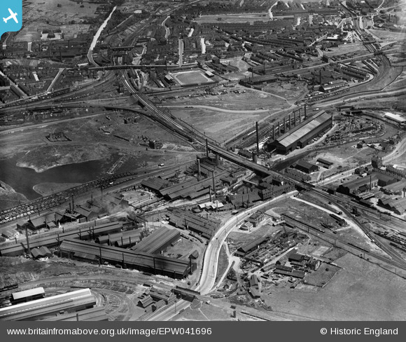
EPW041696 ENGLAND (1933). The Phoenix Special Steel Works and environs, Rotherham, 1933
© Hawlfraint cyfranwyr OpenStreetMap a thrwyddedwyd gan yr OpenStreetMap Foundation. 2026. Trwyddedir y gartograffeg fel CC BY-SA.
Delweddau cyfagos (23)
EPW041696

EAW029399

EAW025970

EPW041699

EPW041695

EAW030486

EPW041705

EPW041698

EAW025968

EAW030485

EPW015446

EAW030488

EAW024153

EAW025974

EAW029397

EAW030492

EPW015445

EAW025971

EPW041697

EAW030487

EAW030494

EPW048728

EAW049659

Manylion
| Pennawd | [EPW041696] The Phoenix Special Steel Works and environs, Rotherham, 1933 |
| Cyfeirnod | EPW041696 |
| Dyddiad | June-1933 |
| Dolen | |
| Enw lle | ROTHERHAM |
| Plwyf | |
| Ardal | |
| Gwlad | ENGLAND |
| Dwyreiniad / Gogleddiad | 441775, 391996 |
| Hydred / Lledred | -1.3712947979142, 53.42284520773 |
| Cyfeirnod Grid Cenedlaethol | SK418920 |
Pinnau
MandM |
Wednesday 12th of November 2014 07:54:57 PM | |
MandM |
Wednesday 12th of November 2014 07:53:57 PM | |
MandM |
Wednesday 12th of November 2014 07:52:53 PM | |
MandM |
Wednesday 12th of November 2014 07:51:58 PM |