
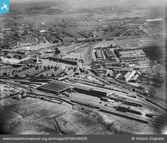
EPW048638 ENGLAND (1935). The Buckley Wells railway depot and environs, Bury, from the west, 1935
© Hawlfraint cyfranwyr OpenStreetMap a thrwyddedwyd gan yr OpenStreetMap Foundation. 2026. Trwyddedir y gartograffeg fel CC BY-SA.
Delweddau cyfagos (9)
EPW048638

EPW048640

EPW047494

EPW048657

EPW048642

EPW047496

EPW047493

EPW046164

EPW047495

Manylion
| Pennawd | [EPW048638] The Buckley Wells railway depot and environs, Bury, from the west, 1935 |
| Cyfeirnod | EPW048638 |
| Dyddiad | July-1935 |
| Dolen | |
| Enw lle | BURY |
| Plwyf | |
| Ardal | |
| Gwlad | ENGLAND |
| Dwyreiniad / Gogleddiad | 379964, 410133 |
| Hydred / Lledred | -2.3027047095683, 53.587158657402 |
| Cyfeirnod Grid Cenedlaethol | SD800101 |
Pinnau


Cyfraniadau Grŵp

Lancashire Fusiliers Boer War, War Memorial, Whitehead Gardens, Bury, 25/08/2014 |

Class31 |
Wednesday 15th of October 2014 04:20:47 PM |