
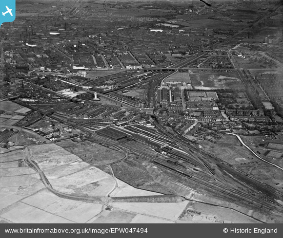
EPW047494 ENGLAND (1935). The Buckley Wells railway depot and the town, Bury, from the west, 1935
© Hawlfraint cyfranwyr OpenStreetMap a thrwyddedwyd gan yr OpenStreetMap Foundation. 2026. Trwyddedir y gartograffeg fel CC BY-SA.
Delweddau cyfagos (9)
EPW047494

EPW048642

EPW048640

EPW048638

EPW047496

EPW048657

EPW047493

EPW047495

EPW046164

Manylion
| Pennawd | [EPW047494] The Buckley Wells railway depot and the town, Bury, from the west, 1935 |
| Cyfeirnod | EPW047494 |
| Dyddiad | May-1935 |
| Dolen | |
| Enw lle | BURY |
| Plwyf | |
| Ardal | |
| Gwlad | ENGLAND |
| Dwyreiniad / Gogleddiad | 379917, 410131 |
| Hydred / Lledred | -2.3034146477959, 53.587138880555 |
| Cyfeirnod Grid Cenedlaethol | SD799101 |
Pinnau

tweetysrevenge |
Saturday 16th of January 2021 09:45:09 PM | |

Class31 |
Monday 1st of September 2014 03:20:24 PM | |
|
Class31 |
Monday 1st of September 2014 03:19:49 PM | |
 |
Class31 |
Monday 1st of September 2014 03:19:05 PM |
|
Class31 |
Monday 1st of September 2014 03:18:28 PM |


