
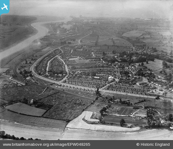
EPW048265 ENGLAND (1935). The residential area surrounding Portway and Springfield Avenue, Shirehampton, 1935
© Hawlfraint cyfranwyr OpenStreetMap a thrwyddedwyd gan yr OpenStreetMap Foundation. 2026. Trwyddedir y gartograffeg fel CC BY-SA.
Delweddau cyfagos (4)
EPW048265

EPW048266

EPW048264

EPW048268

Manylion
| Pennawd | [EPW048265] The residential area surrounding Portway and Springfield Avenue, Shirehampton, 1935 |
| Cyfeirnod | EPW048265 |
| Dyddiad | July-1935 |
| Dolen | |
| Enw lle | SHIREHAMPTON |
| Plwyf | |
| Ardal | |
| Gwlad | ENGLAND |
| Dwyreiniad / Gogleddiad | 353050, 176711 |
| Hydred / Lledred | -2.676263572406, 51.4869130123 |
| Cyfeirnod Grid Cenedlaethol | ST531767 |
Pinnau

NicTomkins |
Tuesday 30th of September 2014 08:31:56 PM | |
|
Geoff |
Tuesday 22nd of July 2014 04:19:41 PM | |
|
Geoff |
Tuesday 22nd of July 2014 04:16:55 PM | |
|
Geoff |
Tuesday 22nd of July 2014 04:16:11 PM | |
|
john pullen |
Thursday 19th of September 2013 08:10:48 PM |