
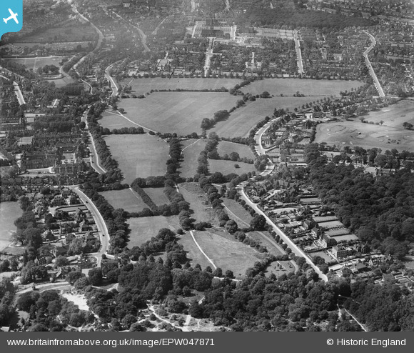
EPW047871 ENGLAND (1935). The Hampstead Heath Extension, Hampstead Garden Suburb, from the south-east, 1935
© Hawlfraint cyfranwyr OpenStreetMap a thrwyddedwyd gan yr OpenStreetMap Foundation. 2026. Trwyddedir y gartograffeg fel CC BY-SA.
Delweddau cyfagos (3)
EPW047871

EPW047870

EPW047883

Manylion
| Pennawd | [EPW047871] The Hampstead Heath Extension, Hampstead Garden Suburb, from the south-east, 1935 |
| Cyfeirnod | EPW047871 |
| Dyddiad | June-1935 |
| Dolen | |
| Enw lle | HAMPSTEAD GARDEN SUBURB |
| Plwyf | |
| Ardal | |
| Gwlad | ENGLAND |
| Dwyreiniad / Gogleddiad | 526162, 187375 |
| Hydred / Lledred | -0.17937782365872, 51.570635844005 |
| Cyfeirnod Grid Cenedlaethol | TQ262874 |
Pinnau
Byddwch y cyntaf i ychwanegu sylw at y ddelwedd hon!