
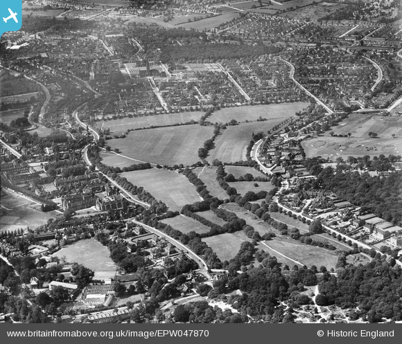
EPW047870 ENGLAND (1935). The Hampstead Heath Extension, Hampstead Garden Suburb, from the south, 1935
© Hawlfraint cyfranwyr OpenStreetMap a thrwyddedwyd gan yr OpenStreetMap Foundation. 2026. Trwyddedir y gartograffeg fel CC BY-SA.
Delweddau cyfagos (5)
EPW047870

EPW047871

EPW028179

EPW028980

EPW015732

Manylion
| Pennawd | [EPW047870] The Hampstead Heath Extension, Hampstead Garden Suburb, from the south, 1935 |
| Cyfeirnod | EPW047870 |
| Dyddiad | June-1935 |
| Dolen | |
| Enw lle | HAMPSTEAD GARDEN SUBURB |
| Plwyf | |
| Ardal | |
| Gwlad | ENGLAND |
| Dwyreiniad / Gogleddiad | 526049, 187338 |
| Hydred / Lledred | -0.18102089864825, 51.570328571719 |
| Cyfeirnod Grid Cenedlaethol | TQ260873 |
Pinnau
Byddwch y cyntaf i ychwanegu sylw at y ddelwedd hon!