
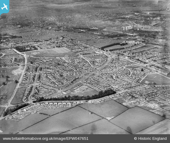
EPW047651 ENGLAND (1935). Housing development at Hallam Crescent East and Coalpit Lane, Braunstone Park, from the south-west, 1935
© Hawlfraint cyfranwyr OpenStreetMap a thrwyddedwyd gan yr OpenStreetMap Foundation. 2026. Trwyddedir y gartograffeg fel CC BY-SA.
Delweddau cyfagos (3)
EPW047651

EPW047650

EPW047652

Manylion
| Pennawd | [EPW047651] Housing development at Hallam Crescent East and Coalpit Lane, Braunstone Park, from the south-west, 1935 |
| Cyfeirnod | EPW047651 |
| Dyddiad | June-1935 |
| Dolen | |
| Enw lle | BRAUNSTONE PARK |
| Plwyf | |
| Ardal | |
| Gwlad | ENGLAND |
| Dwyreiniad / Gogleddiad | 456132, 302401 |
| Hydred / Lledred | -1.1708340686771, 52.616122535113 |
| Cyfeirnod Grid Cenedlaethol | SK561024 |
Pinnau

makycom |
Saturday 18th of September 2021 03:25:44 PM | |
|
robes |
Friday 11th of April 2014 12:53:19 AM | |
|
robes |
Friday 11th of April 2014 12:51:48 AM | |
|
robes |
Friday 11th of April 2014 12:48:08 AM | |
|
robes |
Friday 11th of April 2014 12:47:02 AM |