
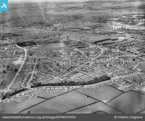
EPW047650 ENGLAND (1935). Housing development at Hallam Crescent East and Coalpit Lane, Braunstone Park, from the south-west, 1935. This image has been produced from a damaged negative.
© Hawlfraint cyfranwyr OpenStreetMap a thrwyddedwyd gan yr OpenStreetMap Foundation. 2026. Trwyddedir y gartograffeg fel CC BY-SA.
Delweddau cyfagos (3)
EPW047650

EPW047651

EPW047652

Manylion
| Pennawd | [EPW047650] Housing development at Hallam Crescent East and Coalpit Lane, Braunstone Park, from the south-west, 1935. This image has been produced from a damaged negative. |
| Cyfeirnod | EPW047650 |
| Dyddiad | June-1935 |
| Dolen | |
| Enw lle | BRAUNSTONE PARK |
| Plwyf | |
| Ardal | |
| Gwlad | ENGLAND |
| Dwyreiniad / Gogleddiad | 456194, 302442 |
| Hydred / Lledred | -1.1699113551441, 52.616484706009 |
| Cyfeirnod Grid Cenedlaethol | SK562024 |
Pinnau
Byddwch y cyntaf i ychwanegu sylw at y ddelwedd hon!