
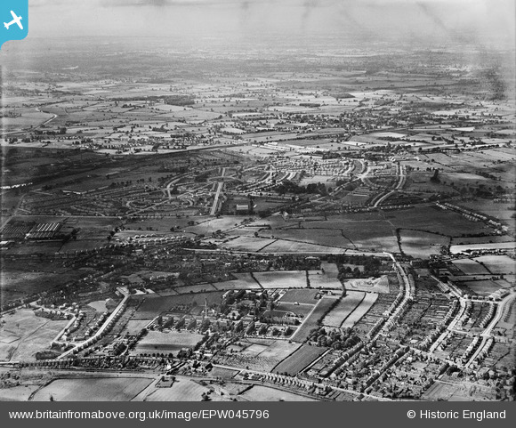
EPW045796 ENGLAND (1934). New housing development at Low Hill, New Cross Workhouse and Infirmary and environs, Heath Town, from the south-east, 1934
© Hawlfraint cyfranwyr OpenStreetMap a thrwyddedwyd gan yr OpenStreetMap Foundation. 2026. Trwyddedir y gartograffeg fel CC BY-SA.
Delweddau cyfagos (13)
EPW045796

EPW045515

EPW045516

EPW045517

EPW045521

EPW045518

EPW045522

EPW045794

EPW045523

EPW045524

EPW045793

EPW011776
, Wolverhampton, 1924. This image has been produced from a print.")
EPW045520

Manylion
| Pennawd | [EPW045796] New housing development at Low Hill, New Cross Workhouse and Infirmary and environs, Heath Town, from the south-east, 1934 |
| Cyfeirnod | EPW045796 |
| Dyddiad | August-1934 |
| Dolen | |
| Enw lle | HEATH TOWN |
| Plwyf | |
| Ardal | |
| Gwlad | ENGLAND |
| Dwyreiniad / Gogleddiad | 393551, 300395 |
| Hydred / Lledred | -2.0952290167944, 52.600950384583 |
| Cyfeirnod Grid Cenedlaethol | SJ936004 |
Pinnau

fillipfruit |
Thursday 4th of November 2021 06:50:48 PM | |
|
Big Mike |
Thursday 25th of September 2014 07:01:34 PM |