
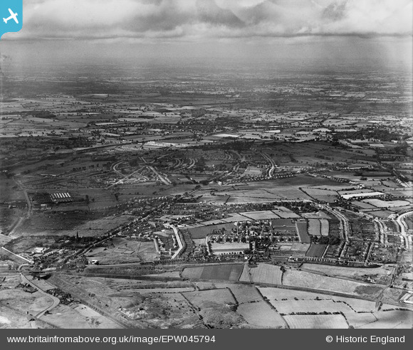
EPW045794 ENGLAND (1934). New housing development at Low Hill, New Cross Workhouse and Infirmary and environs, Heath Town, from the south-east, 1934
© Hawlfraint cyfranwyr OpenStreetMap a thrwyddedwyd gan yr OpenStreetMap Foundation. 2026. Trwyddedir y gartograffeg fel CC BY-SA.
Delweddau cyfagos (10)
EPW045794

EPW045522

EPW011776
, Wolverhampton, 1924. This image has been produced from a print.")
EPW045515

EPW045796

EPW045797

EPW045518

EPW045517

EPW045516

EPW045521

Manylion
| Pennawd | [EPW045794] New housing development at Low Hill, New Cross Workhouse and Infirmary and environs, Heath Town, from the south-east, 1934 |
| Cyfeirnod | EPW045794 |
| Dyddiad | August-1934 |
| Dolen | |
| Enw lle | HEATH TOWN |
| Plwyf | |
| Ardal | |
| Gwlad | ENGLAND |
| Dwyreiniad / Gogleddiad | 393458, 300229 |
| Hydred / Lledred | -2.0965990140491, 52.599456797823 |
| Cyfeirnod Grid Cenedlaethol | SJ935002 |
Pinnau

Martin |
Wednesday 11th of December 2013 06:25:28 PM |