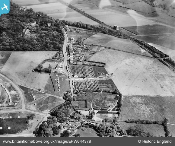
EPW044378 ENGLAND (1934). Hurst Road and environs, Bexley Woods, 1934
    © Hawlfraint cyfranwyr OpenStreetMap a thrwyddedwyd gan yr OpenStreetMap Foundation. 2025. Trwyddedir y gartograffeg fel CC BY-SA.
  
Delweddau cyfagos (11)
Manylion
| Pennawd | [EPW044378] Hurst Road and environs, Bexley Woods, 1934 | 
| Cyfeirnod | EPW044378 | 
| Dyddiad | May-1934 | 
| Dolen | |
| Enw lle | BEXLEY WOODS | 
| Plwyf | |
| Ardal | |
| Gwlad | ENGLAND | 
| Dwyreiniad / Gogleddiad | 548024, 173134 | 
| Hydred / Lledred | 0.12991378130859, 51.437346276033 | 
| Cyfeirnod Grid Cenedlaethol | TQ480731 | 
Pinnau
Byddwch y cyntaf i ychwanegu sylw at y ddelwedd hon!
 
             
  ![[EPW044378] Hurst Road and environs, Bexley Woods, 1934](http://britainfromabove.org.uk/sites/all/libraries/aerofilms-images/public/100x100/EPW/044/EPW044378.jpg) 
  
                                          ![[EPW044379] Hurst Road and environs, Bexley Woods, 1934](http://britainfromabove.org.uk/sites/all/libraries/aerofilms-images/public/100x100/EPW/044/EPW044379.jpg) 
 ![[EPW044377] Hurst Road and environs, Bexley Woods, 1934](http://britainfromabove.org.uk/sites/all/libraries/aerofilms-images/public/100x100/EPW/044/EPW044377.jpg) 
 ![[EPW044736] Hurst Road, Valentine Avenue, the SR Dartford Loop and environs, Bexley Woods, 1934](http://britainfromabove.org.uk/sites/all/libraries/aerofilms-images/public/100x100/EPW/044/EPW044736.jpg) 
 ![[EPW044735] Hurst Road, the SR Dartford Loop and environs, Bexley Woods, 1934](http://britainfromabove.org.uk/sites/all/libraries/aerofilms-images/public/100x100/EPW/044/EPW044735.jpg) 
 ![[EPW044734] Hurst Road, the SR Dartford Loop and environs, Bexley Woods, 1934](http://britainfromabove.org.uk/sites/all/libraries/aerofilms-images/public/100x100/EPW/044/EPW044734.jpg) 
 ![[EPW044376] The SR Dartford Loop Line and housing under construction to the north of Hurst Road along Dorchester Avenue and Murchison Avenue, Bexley Woods, 1934](http://britainfromabove.org.uk/sites/all/libraries/aerofilms-images/public/100x100/EPW/044/EPW044376.jpg) 
 ![[EPW044733] Hurst Place and environs, Sidcup, 1934](http://britainfromabove.org.uk/sites/all/libraries/aerofilms-images/public/100x100/EPW/044/EPW044733.jpg) 
 ![[EPW044732] Hurst Road, the SR Dartford Loop and environs, Bexley Woods, 1934](http://britainfromabove.org.uk/sites/all/libraries/aerofilms-images/public/100x100/EPW/044/EPW044732.jpg) 
 ![[EPW044718] The Albany Park Estate under construction centred upon Murchison, Dorchester and Crofton Avenues, Bexley Woods, from the south-east, 1934](http://britainfromabove.org.uk/sites/all/libraries/aerofilms-images/public/100x100/EPW/044/EPW044718.jpg) 
 ![[EPW044719] The Albany Park Estate under construction centred upon Murchison, Dorchester and Crofton Avenues, Bexley Woods, from the south-east, 1934](http://britainfromabove.org.uk/sites/all/libraries/aerofilms-images/public/100x100/EPW/044/EPW044719.jpg)