
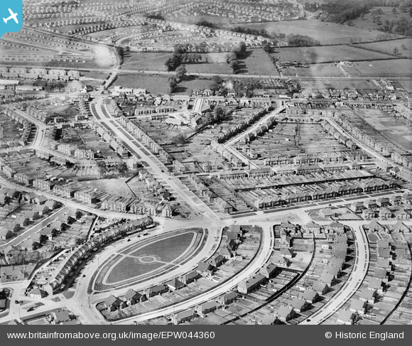
EPW044360 ENGLAND (1934). The Oval, Wellington Avenue and environs, Blackfen, 1934
© Hawlfraint cyfranwyr OpenStreetMap a thrwyddedwyd gan yr OpenStreetMap Foundation. 2026. Trwyddedir y gartograffeg fel CC BY-SA.
Delweddau cyfagos (8)
EPW044360

EPW044362

EPW044361

EPW038435

EPW038438

EPW038433

EPW038436

EPW038437

Manylion
| Pennawd | [EPW044360] The Oval, Wellington Avenue and environs, Blackfen, 1934 |
| Cyfeirnod | EPW044360 |
| Dyddiad | May-1934 |
| Dolen | |
| Enw lle | BLACKFEN |
| Plwyf | |
| Ardal | |
| Gwlad | ENGLAND |
| Dwyreiniad / Gogleddiad | 546336, 174129 |
| Hydred / Lledred | 0.10605433636786, 51.446726476132 |
| Cyfeirnod Grid Cenedlaethol | TQ463741 |
Pinnau

Mike Floate |
Tuesday 24th of December 2013 08:30:03 PM |