
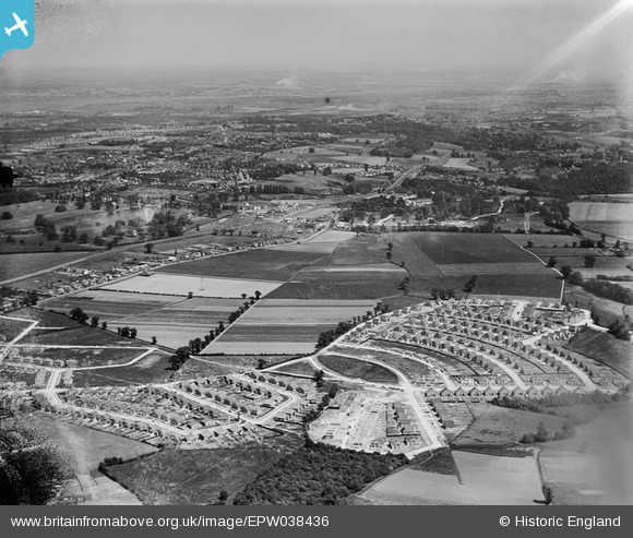
EPW038436 ENGLAND (1932). New housing site near Blackfen, Bexley, from the west, 1932
© Hawlfraint cyfranwyr OpenStreetMap a thrwyddedwyd gan yr OpenStreetMap Foundation. 2026. Trwyddedir y gartograffeg fel CC BY-SA.
Delweddau cyfagos (10)
EPW038436

EPW038433

EPW044394

EPW044397

EPW038435

EPW038431

EPW044395

EPW044360

EPW044362

EPW038434

Manylion
| Pennawd | [EPW038436] New housing site near Blackfen, Bexley, from the west, 1932 |
| Cyfeirnod | EPW038436 |
| Dyddiad | 14-June-1932 |
| Dolen | |
| Enw lle | BEXLEY |
| Plwyf | |
| Ardal | |
| Gwlad | ENGLAND |
| Dwyreiniad / Gogleddiad | 546291, 173938 |
| Hydred / Lledred | 0.10532820322046, 51.445021679959 |
| Cyfeirnod Grid Cenedlaethol | TQ463739 |
Pinnau

Barney |
Saturday 13th of December 2025 03:51:25 PM | |
|
Barney |
Saturday 13th of December 2025 03:51:04 PM | |
|
Barney |
Saturday 13th of December 2025 03:48:59 PM | |
|
Barney |
Saturday 13th of December 2025 03:48:28 PM | |
|
Barney |
Saturday 13th of December 2025 03:47:59 PM | |
|
Barney |
Saturday 13th of December 2025 03:47:29 PM | |
|
Barney |
Saturday 13th of December 2025 03:47:26 PM | |
|
Barney |
Saturday 13th of December 2025 03:46:55 PM | |
|
Barney |
Saturday 13th of December 2025 03:44:55 PM | |
|
Barney |
Saturday 13th of December 2025 03:44:33 PM | |
|
Barney |
Saturday 13th of December 2025 03:44:07 PM | |
|
Barney |
Saturday 13th of December 2025 03:43:32 PM | |
|
Barney |
Saturday 13th of December 2025 03:42:18 PM | |
|
Barney |
Saturday 13th of December 2025 03:41:55 PM | |
|
Barney |
Saturday 13th of December 2025 03:41:33 PM | |
|
Barney |
Saturday 13th of December 2025 03:40:46 PM | |
|
Barney |
Saturday 13th of December 2025 03:36:09 PM | |

jackespie |
Friday 12th of April 2024 08:05:35 PM |