
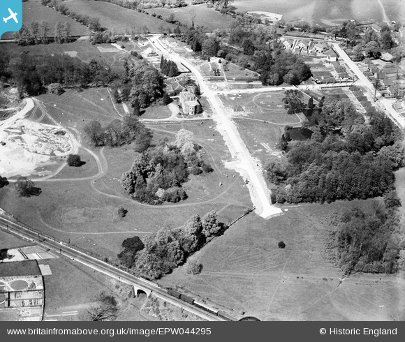
EPW044295 ENGLAND (1934). Construction of housing on Robyns Way, Sevenoaks, 1934
© Hawlfraint cyfranwyr OpenStreetMap a thrwyddedwyd gan yr OpenStreetMap Foundation. 2026. Trwyddedir y gartograffeg fel CC BY-SA.
Delweddau cyfagos (5)
EPW044295

EPW044294

EPW044292

EPW044293

EPW044296

Manylion
| Pennawd | [EPW044295] Construction of housing on Robyns Way, Sevenoaks, 1934 |
| Cyfeirnod | EPW044295 |
| Dyddiad | May-1934 |
| Dolen | |
| Enw lle | SEVENOAKS |
| Plwyf | SEVENOAKS |
| Ardal | |
| Gwlad | ENGLAND |
| Dwyreiniad / Gogleddiad | 551918, 156041 |
| Hydred / Lledred | 0.17859885422839, 51.282714267748 |
| Cyfeirnod Grid Cenedlaethol | TQ519560 |
Pinnau

John Wass |
Saturday 27th of September 2014 02:02:57 PM |