
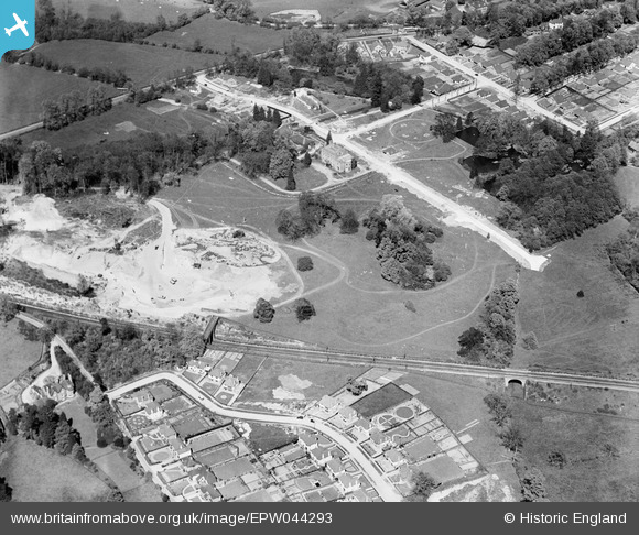
EPW044293 ENGLAND (1934). Construction of housing on Robyns Way, Sevenoaks, 1934
© Hawlfraint cyfranwyr OpenStreetMap a thrwyddedwyd gan yr OpenStreetMap Foundation. 2026. Trwyddedir y gartograffeg fel CC BY-SA.
Delweddau cyfagos (5)
EPW044293

EPW044292

EPW044295

EPW044294

EPW044296

Manylion
| Pennawd | [EPW044293] Construction of housing on Robyns Way, Sevenoaks, 1934 |
| Cyfeirnod | EPW044293 |
| Dyddiad | May-1934 |
| Dolen | |
| Enw lle | SEVENOAKS |
| Plwyf | SEVENOAKS |
| Ardal | |
| Gwlad | ENGLAND |
| Dwyreiniad / Gogleddiad | 551883, 156055 |
| Hydred / Lledred | 0.17810327489204, 51.282849411044 |
| Cyfeirnod Grid Cenedlaethol | TQ519561 |
Pinnau
Byddwch y cyntaf i ychwanegu sylw at y ddelwedd hon!