
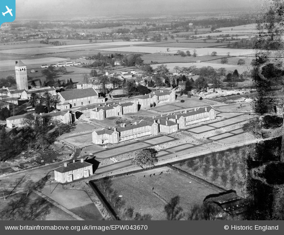
EPW043670 ENGLAND (1933). Shenley Mental Hospital and environs, Shenley, from the south, 1933. This image has been produced from a damaged negative.
© Hawlfraint cyfranwyr OpenStreetMap a thrwyddedwyd gan yr OpenStreetMap Foundation. 2026. Trwyddedir y gartograffeg fel CC BY-SA.
Delweddau cyfagos (39)
EPW043670

EPW043664

EAW019110

EAW019112

EPW043672

EPW043665

EPW044107

EAW018904

EPW044105

EAW018908
, Shenley, from the south-east, 1948. This image has been produced from a damaged negative.")
EAW018909

EPW043667

EPW044103

EPW044109

EAW019115

EPW044111

EPW044108

EPW043668

EAW018907

EPW043671

EAW018905

EPW043674

EAW019108

EPW044110

EPW044101

EPW044102

EPW044104

EPW043669

EAW018910

EAW019111

EPW043666

EAW019113

EAW018900

EPW043675

EPW044106

EPW043673

EPW049672

EPW043677

EPW044112

Manylion
| Pennawd | [EPW043670] Shenley Mental Hospital and environs, Shenley, from the south, 1933. This image has been produced from a damaged negative. |
| Cyfeirnod | EPW043670 |
| Dyddiad | December-1933 |
| Dolen | |
| Enw lle | SHENLEY |
| Plwyf | SHENLEY |
| Ardal | |
| Gwlad | ENGLAND |
| Dwyreiniad / Gogleddiad | 518312, 200737 |
| Hydred / Lledred | -0.28808743717182, 51.692439742279 |
| Cyfeirnod Grid Cenedlaethol | TL183007 |
Pinnau
Byddwch y cyntaf i ychwanegu sylw at y ddelwedd hon!