
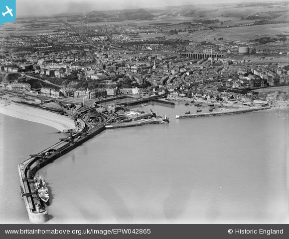
EPW042865 ENGLAND (1933). The Harbour Pier, Inner and Outer Harbours and the town, Folkestone, 1933
© Hawlfraint cyfranwyr OpenStreetMap a thrwyddedwyd gan yr OpenStreetMap Foundation. 2026. Trwyddedir y gartograffeg fel CC BY-SA.
Delweddau cyfagos (12)
EPW042865

EAW024826

EAW006157

EAW317182

EPW000149

EPW042866

EPW035410

EPW000372

EAW002849

EAW002850

EAW002378

EAW002848

Manylion
| Pennawd | [EPW042865] The Harbour Pier, Inner and Outer Harbours and the town, Folkestone, 1933 |
| Cyfeirnod | EPW042865 |
| Dyddiad | August-1933 |
| Dolen | |
| Enw lle | FOLKESTONE |
| Plwyf | FOLKESTONE |
| Ardal | |
| Gwlad | ENGLAND |
| Dwyreiniad / Gogleddiad | 623492, 135896 |
| Hydred / Lledred | 1.1910483356056, 51.07825630651 |
| Cyfeirnod Grid Cenedlaethol | TR235359 |
Pinnau

Sara |
Saturday 4th of August 2018 09:04:13 AM | |
|
Sara |
Saturday 4th of August 2018 09:02:29 AM | |
|
Sara |
Saturday 4th of August 2018 09:01:22 AM | |
|
Sara |
Saturday 4th of August 2018 09:00:27 AM | |
|
Sara |
Saturday 4th of August 2018 08:58:51 AM |