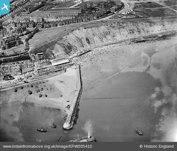
EPW035410 ENGLAND (1931). The Harbour Lighthouse, the Outer Harbour and East Cliff, Folkestone, 1931
    © Hawlfraint cyfranwyr OpenStreetMap a thrwyddedwyd gan yr OpenStreetMap Foundation. 2025. Trwyddedir y gartograffeg fel CC BY-SA.
  
Delweddau cyfagos (7)
Manylion
| Pennawd | [EPW035410] The Harbour Lighthouse, the Outer Harbour and East Cliff, Folkestone, 1931 | 
| Cyfeirnod | EPW035410 | 
| Dyddiad | 25-May-1931 | 
| Dolen | |
| Enw lle | FOLKESTONE | 
| Plwyf | FOLKESTONE | 
| Ardal | |
| Gwlad | ENGLAND | 
| Dwyreiniad / Gogleddiad | 623563, 136098 | 
| Hydred / Lledred | 1.1921853396597, 51.080042445007 | 
| Cyfeirnod Grid Cenedlaethol | TR236361 | 
Pinnau
|  Developed as Sunny Sands beach. |   Sara | Saturday 4th of August 2018 08:35:00 AM | 
 
             
  ![[EPW035410] The Harbour Lighthouse, the Outer Harbour and East Cliff, Folkestone, 1931](http://britainfromabove.org.uk/sites/all/libraries/aerofilms-images/public/100x100/EPW/035/EPW035410.jpg) 
  
                                          ![[EAW002378] Folkestone Harbour Pier and the town, Folkestone, 1946](http://britainfromabove.org.uk/sites/all/libraries/aerofilms-images/public/100x100/EAW/002/EAW002378.jpg) 
 ![[EAW006157] Folkestone Harbour, Folkestone, 1947](http://britainfromabove.org.uk/sites/all/libraries/aerofilms-images/public/100x100/EAW/006/EAW006157.jpg) 
 ![[EPW000149] Outer Harbour and Fish Market, Folkestone, 1920](http://britainfromabove.org.uk/sites/all/libraries/aerofilms-images/public/100x100/EPW/000/EPW000149.jpg) 
 ![[EAW024826] The harbour, Folkestone, 1949](http://britainfromabove.org.uk/sites/all/libraries/aerofilms-images/public/100x100/EAW/024/EAW024826.jpg) 
 ![[EPW042865] The Harbour Pier, Inner and Outer Harbours and the town, Folkestone, 1933](http://britainfromabove.org.uk/sites/all/libraries/aerofilms-images/public/100x100/EPW/042/EPW042865.jpg) 
 ![[EAW317182] Town and harbour, Folkestone, 1976](http://britainfromabove.org.uk/sites/all/libraries/aerofilms-images/public/100x100/EAW/317/EAW317182.jpg)