
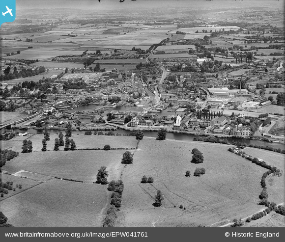
EPW041761 ENGLAND (1933). The town, Stourport-on-Severn, from the south, 1933
© Hawlfraint cyfranwyr OpenStreetMap a thrwyddedwyd gan yr OpenStreetMap Foundation. 2026. Trwyddedir y gartograffeg fel CC BY-SA.
Delweddau cyfagos (5)
EPW041761

EPW061731

EPW061728

EPW061730

EPW061729

Manylion
| Pennawd | [EPW041761] The town, Stourport-on-Severn, from the south, 1933 |
| Cyfeirnod | EPW041761 |
| Dyddiad | June-1933 |
| Dolen | |
| Enw lle | STOURPORT-ON-SEVERN |
| Plwyf | STOURPORT-ON-SEVERN |
| Ardal | |
| Gwlad | ENGLAND |
| Dwyreiniad / Gogleddiad | 381026, 270719 |
| Hydred / Lledred | -2.2784885099557, 52.333842763442 |
| Cyfeirnod Grid Cenedlaethol | SO810707 |
Pinnau

GR |
Saturday 8th of November 2025 12:31:11 PM | |
|
gBr |
Sunday 30th of June 2019 10:58:42 PM | |
|
ladyland68 |
Thursday 3rd of April 2014 08:34:33 PM | |
|
ladyland68 |
Tuesday 5th of November 2013 07:43:32 PM |