
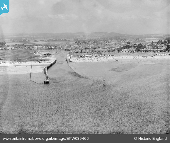
EPW039466 ENGLAND (1932). The mouth of the River Arun, the town and the seafront, Littlehampton, from the south, 1932
© Hawlfraint cyfranwyr OpenStreetMap a thrwyddedwyd gan yr OpenStreetMap Foundation. 2026. Trwyddedir y gartograffeg fel CC BY-SA.
Delweddau cyfagos (3)
EPW039466

EPW040098

EAW012237

Manylion
| Pennawd | [EPW039466] The mouth of the River Arun, the town and the seafront, Littlehampton, from the south, 1932 |
| Cyfeirnod | EPW039466 |
| Dyddiad | August-1932 |
| Dolen | |
| Enw lle | LITTLEHAMPTON |
| Plwyf | LITTLEHAMPTON |
| Ardal | |
| Gwlad | ENGLAND |
| Dwyreiniad / Gogleddiad | 502972, 100831 |
| Hydred / Lledred | -0.53871166413407, 50.797317737692 |
| Cyfeirnod Grid Cenedlaethol | TQ030008 |
Pinnau
Byddwch y cyntaf i ychwanegu sylw at y ddelwedd hon!