
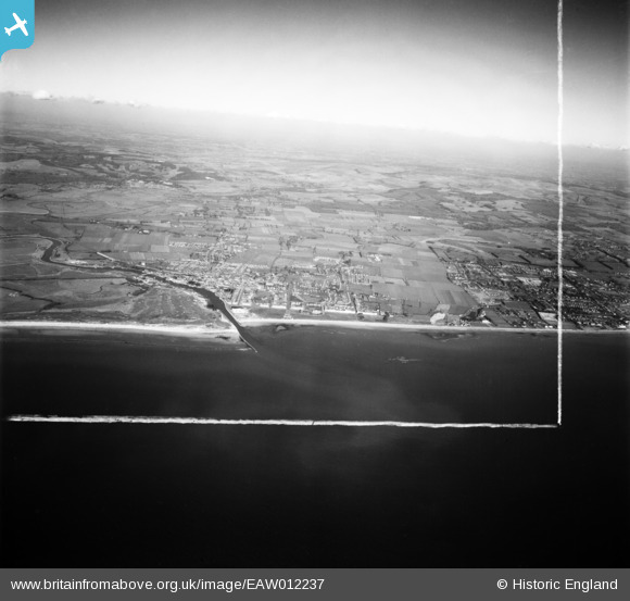
EAW012237 ENGLAND (1947). The town and surrounding countryside at Poling and Arundel, Littlehampton, from the south, 1947. This image was marked by Aerofilms Ltd for photo editing.
© Hawlfraint cyfranwyr OpenStreetMap a thrwyddedwyd gan yr OpenStreetMap Foundation. 2026. Trwyddedir y gartograffeg fel CC BY-SA.
Delweddau cyfagos (3)
EAW012237

EPW040098

EPW039466

Manylion
| Pennawd | [EAW012237] The town and surrounding countryside at Poling and Arundel, Littlehampton, from the south, 1947. This image was marked by Aerofilms Ltd for photo editing. |
| Cyfeirnod | EAW012237 |
| Dyddiad | 24-November-1947 |
| Dolen | |
| Enw lle | LITTLEHAMPTON |
| Plwyf | LITTLEHAMPTON |
| Ardal | |
| Gwlad | ENGLAND |
| Dwyreiniad / Gogleddiad | 503200, 100956 |
| Hydred / Lledred | -0.53544208265483, 50.798401002084 |
| Cyfeirnod Grid Cenedlaethol | TQ032010 |
Pinnau

John W |
Sunday 18th of September 2016 04:04:39 PM | |
|
John W |
Sunday 18th of September 2016 04:03:24 PM | |
|
John W |
Sunday 18th of September 2016 03:14:54 PM | |
|
John W |
Sunday 18th of September 2016 03:13:29 PM | |
|
John W |
Sunday 18th of September 2016 03:08:53 PM | |
|
John W |
Sunday 18th of September 2016 03:07:33 PM | |
|
John W |
Sunday 18th of September 2016 03:06:49 PM | |
|
John W |
Sunday 18th of September 2016 03:05:19 PM | |
|
John W |
Sunday 18th of September 2016 03:04:37 PM |